
Grottes et karsts de Chine
Sur les traces de Xu Xiake
Sur les traces de Xu Xiake
22 visiteur(s) et 0 membre(s) en ligne.
Grottes
 Tianweishujing 田尾竖井
Détail28/02/2025 20:13:38
Nom de la grotte : Tianweishujing - 田尾竖井
Autres noms : Puits de la queue du champ
Province, Préfecture, District :
Yunnan 云南省, Wenshan 文山壮族苗族自治州, Guangnan 广南县
Latitude Nord - Longitude Est :
23.770289 - 104.971381
Altitude (m) : 1600
Développement (m) : 403
Profondeur (m) : 54
Profondeur - / + (m) : 54 /
Autres noms : Puits de la queue du champ
Province, Préfecture, District :
Yunnan 云南省, Wenshan 文山壮族苗族自治州, Guangnan 广南县
Latitude Nord - Longitude Est :
23.770289 - 104.971381
Altitude (m) : 1600
Développement (m) : 403
Profondeur (m) : 54
Profondeur - / + (m) : 54 /
Carte
-- Description 0
-- Bibliographie 0
-- Images 0
Topographie 1
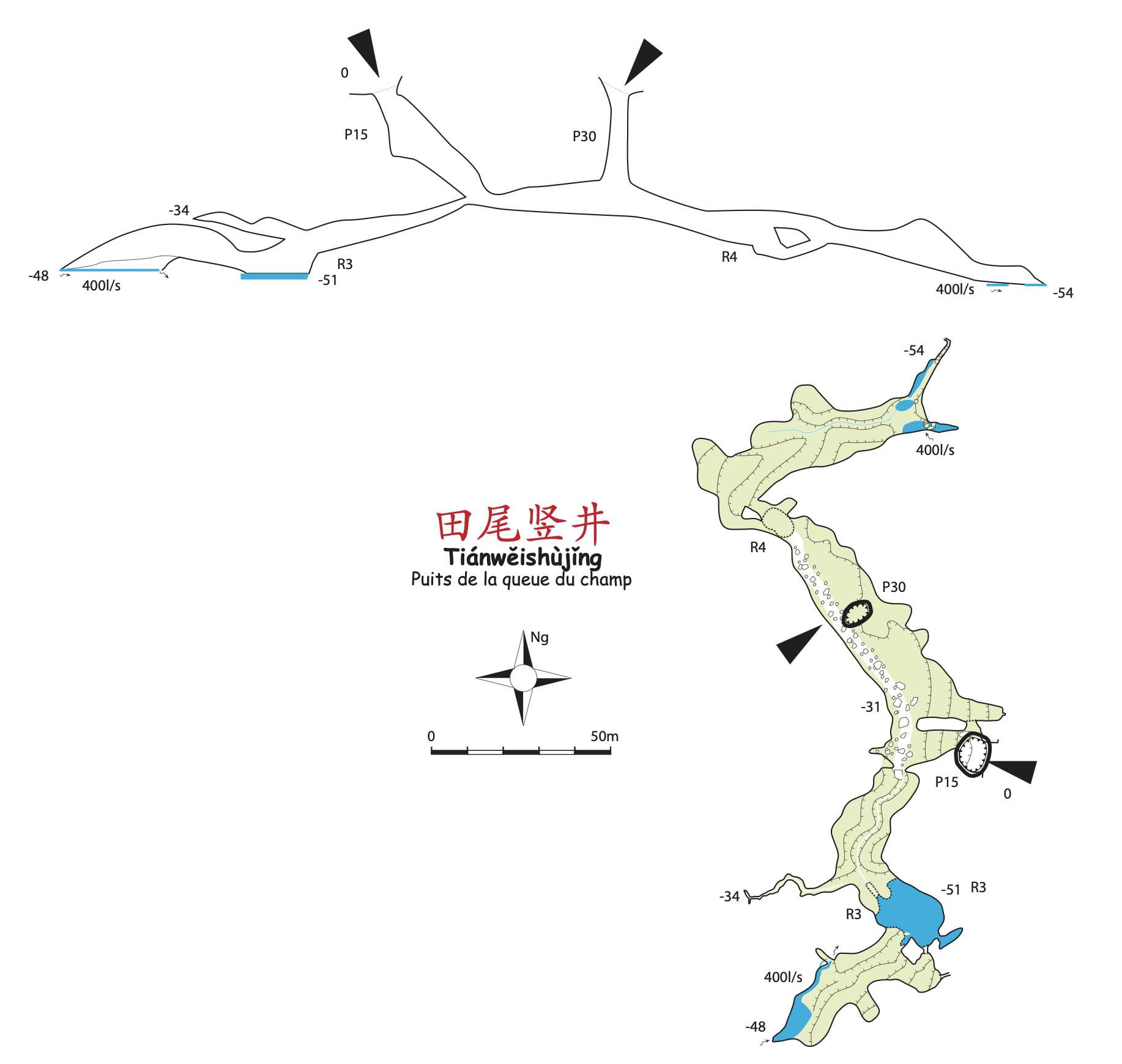
Source : JB-GKC
-- Expédition 0
Recherche