
Grottes et karsts de Chine
Sur les traces de Xu Xiake
 Mujiawandong -
Détail14/01/2025 13:14:27
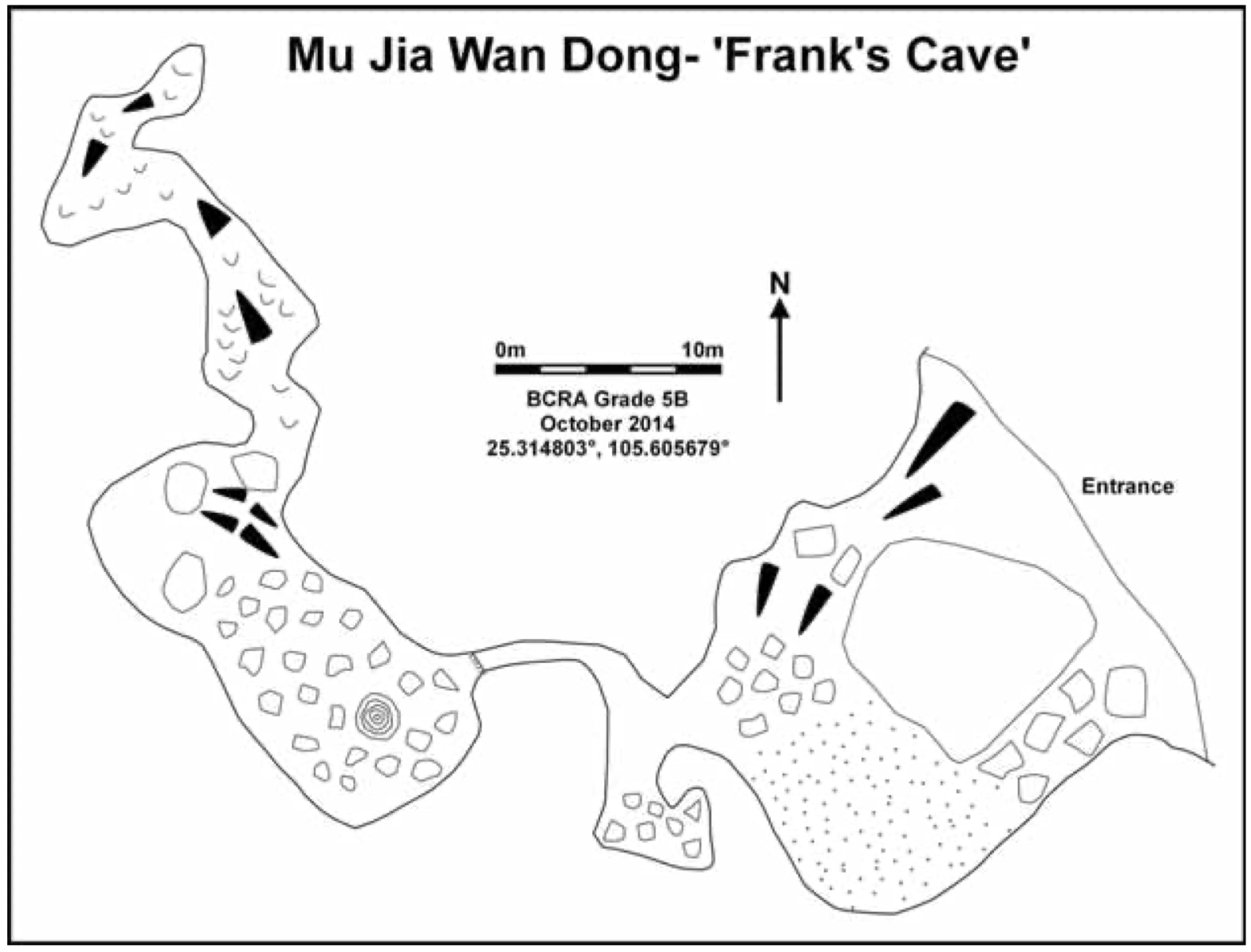
Autres noms : Frank's Cave
Province, Préfecture, District :
Guizhou 贵州省, Qianxinan 黔西南布依族苗族自治州, Anlong 安龙
Latitude Nord - Longitude Est :
25.314803 - 105.605679
Altitude (m) : 0
Développement (m) : 101
Profondeur (m) :
Profondeur - / + (m) : 0 /
Volume (m3) :
Géologie : Trias moyen
Carte
Description 1
Mu Jia Wan Dong –‘Frank’s Cave’- 25.314803°, 105.605679°
The large entrance led down to a sand-floored chamber with light entering from another entrance. Following the obvious passage over a couple of climbs lead to the limit of the first reccee trip, a rift overlooking a ~4 m climb down into a larger chamber. This is relatively straightforward when roped, and the chamber can be followed to the south west to a decorated corner, with an obvious smaller continuation. At this point in the cave there is calcite covering the walls, floor and ceiling, and several climbs immediately terminating, and no ongoing passage.
Aut. Var.The Guilin Institute of Karst Geology In association with the China Caves Project (2014)
The China Caves Project Expedition Report 2014. Report to the Anlong People’s Government
Analyse :
Rapport d’expédition dans le district de Anlong (Guizhou). 69 pages, 3 cartes, 28 photos couleurs, 12 topographies.
629 caractères - Lu 160 Fois
Bibliographie 1
Aut. Var.The Guilin Institute of Karst Geology In association with the China Caves Project (2014)
The China Caves Project Expedition Report 2014. Report to the Anlong People’s Government
Rapport d’expédition dans le district de Anlong (Guizhou). 69 pages, 3 cartes, 28 photos couleurs, 12 topographies.
Source :
Images 0
Topographie 1
Source : Ccp
Expédition 1
Cette grotte a été identifiée ou explorée au minimum par cette (ces) expédition (s) :
Recherche