
Grottes et karsts de Chine
Sur les traces de Xu Xiake
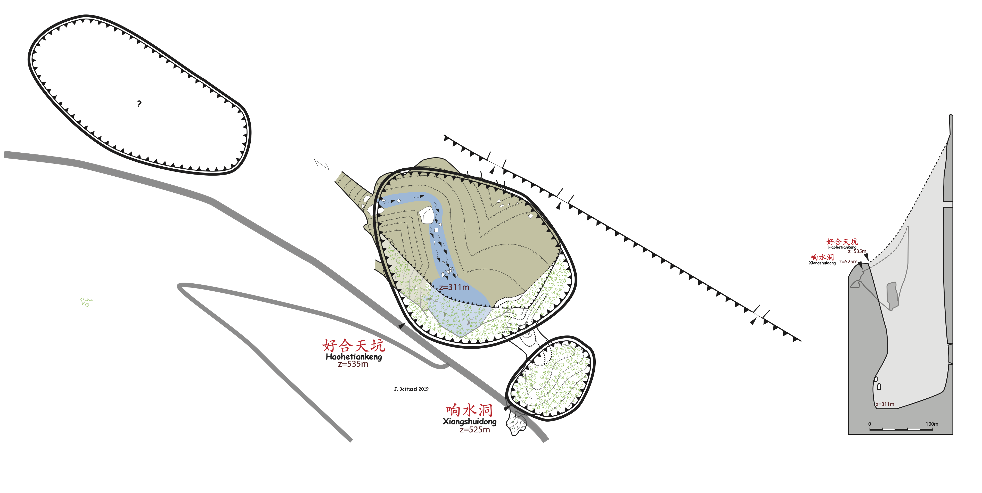
 Xiangshuidong - 响水洞
Détail26/03/2025 18:30:46
Province, Préfecture, District :
Guangxi 广西壮族自治区, Hechi 河池市, Bama 巴马瑶族自治县
Latitude Nord - Longitude Est :
24.363062 - 107.110137
Altitude (m) : 525
Développement (m) : 300
Profondeur (m) : 224
Profondeur - / + (m) : 224 /
Volume (m3) :
Géologie : Carbonifère moyen
Carte
Description 0
Bibliographie 1
WALTHAM, A.C; WILLIS, R.G. (eds.) (1993): Xingwen. China Caves Project 1989-1992.-
Bridgwater TA7 0LG, British Cave Research Association. 48pp. (maps, photos, surveys) (chinese abstract). ISBN 0-900265-15-9.
A report on various projects: The Pan Yang Caves, Bama, Guangxi Province 1989. The Mengzi karst of southern Yunnan 1991. The karst of the Tibet Plateau 1992 and the largest part, the exploration of the Xingwen karst of Sichuan Province 1992. Geomorphol. map of Karst of Xingwen, Sichuan. Cave surveys of : Zhucaojing (Xingwen, Sichuan): 8,80 km +1,75 km; Tiencuan dong (Xingwen, Sichuan): 8,10 km /-208 m; Xia Dong (Xingwen, Sichuan): 2,20 km; Yanzi Luo Shui Dong (Xingwen, Sichuan): 1,80 km /- 316 m + 1,12 km / -199 m; Pan Yang Dong cave system (Bama Guangxi). (RM).
Source : BBS
Images 0
Topographie 1
Source : Gkc
Expédition 1
Cette grotte a été identifiée ou explorée au minimum par cette (ces) expédition (s) :
Recherche