
Grottes et karsts de Chine
Sur les traces de Xu Xiake
 Dashiwei -
Détail26/10/2021 10:46:13
Province, Préfecture, District :
Guangxi 广西壮族自治区, Baise 百色市, Leye 乐业县
Latitude Nord - Longitude Est :
24.806917 - 106.442115
Altitude (m) : 1332
Développement (m) : 6 630
Profondeur (m) : 698
Profondeur - / + (m) : 0 /
Volume (m3) :
Carte
Description 1
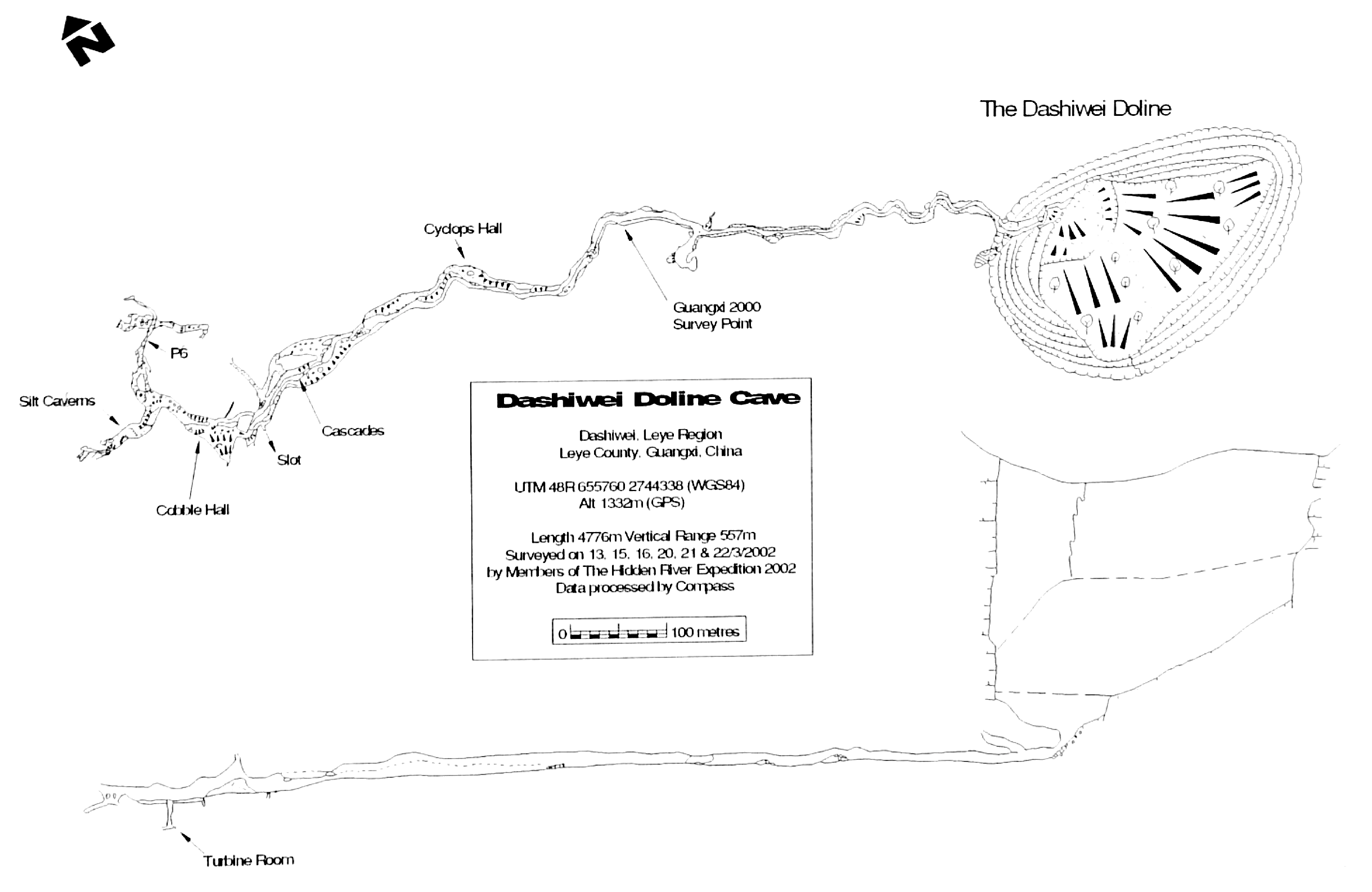
4.5 Dashiwei Doline
Zone 48 - 645760 2744338 Alt 1332m
Survey contains 71 survey stations, joined by 70 shots.
There are 0 loops.
Total length of survey shots = 1189.45m (1189.45m adjusted)
Total plan length of survey shots = 1142.44m
Total vertical length of survey shots = 210.21m
Vertical range = 50.57m (from dashiwei_doline.70 at 38.88m to dashiwei_doline.25 at -11.69m)
North-South range = 426.66m (from dashiwei_doline.1 at 8.98m to dashiwei_doline.67 at -417.68m)
East-West range = 822.11m (from dashiwei_doline.70 at 805.75m to dashiwei_doline.1 at -16.36m) 1-nodes (qty 3)
2-nodes (qty 67)
3-node (qty 1)
A spectacular feature believed to be the 2nd biggest doline (by depth) in the world. This was descended over a 3-day period to a large river cave. It was followed for 1.1km downstream to just beyond the confluence of an equally large river. Progress was made out of the water most of the time, but was only possible by many river crossings. Explored previously by Chinese cavers in July 2000, when there were lower water conditions, but no survey data were taken. Even in those conditions, it is possible for cavers to be swept away.
The water is believed to resurge 30km away at Beilong, so there are significant development possibilities. A daylight camp was made in Zhong Dong, half way down the wall of the doline, and another camp just beyond the cave entrance where it meets the river. It must be noted that the forest area deep within this doline has an isolated and special existence and is very vulnerable. All exploration to this cave needs to take measures to minimise its damage.
AUT. VAR. Collated by GED CAMPION (2001)
The YRC Guangxi Caves 2000 Expedition. The YRC Bulletin Summer 2001 64 p., 45 photos, 4 cartes, 8 topographies
Analyse : gkc-JPB
Résultat des explorations menéees au cours de l’expédition Guangxi Caves 2000 dans la province du Guangxi (Comtés de Leye et Lingyun).
1606 caractères - Lu 142 Fois
Bibliographie 1
AUT. VAR. Collated by GED CAMPION (2001)
The YRC Guangxi Caves 2000 Expedition. The YRC Bulletin Summer 2001 64 p., 45 photos, 4 cartes, 8 topographies
Résultat des explorations menéees au cours de l’expédition Guangxi Caves 2000 dans la province du Guangxi (Comtés de Leye et Lingyun).
Source : gkc-JPB
Images 0
Topographie 1
Source : Ccp
Expédition 2
Cette grotte a été identifiée ou explorée au minimum par cette (ces) expédition (s) :
Recherche