
Grottes et karsts de Chine
Sur les traces de Xu Xiake
Grottes
 Xianghuokeng 香火坑
Détail23/01/2025 9:06
Province, Préfecture, District :
Guizhou 贵州省, Zunyi Shi 遵义市, Wuchuan 务川仡佬族苗族自治县
Latitude Nord - Longitude Est :
28.4025 - 108.0184
Altitude (m) : 1185
Développement (m) : 630
Profondeur (m) : 64
Profondeur - / + (m) : 0 /
Carte
Description 1
Detail of the entrance
There is a small village next to the Xiao chang Dadong, it is in southwest of ShiChao.
Location is 252°from ShiChao, distance is 2.1km. A blind valley is at west side of the village. This valley has limestone cliff on the south side. The valley has a stream that flows to sinkhole in front of entrance. The big entrance is open to northwest in the cliff. The size is 60•20m.
Because the pattern of the rock on entrance looked like the smoke from an incense burner, so this name have been given The stone monument is near the cave. A small fissure cave is beside of the monument.
It will rise before long though the ceiling at the entrance is low. There is pit. We didn’t go down it but the passage might continue because a warm wind blows.
Detail of the cave
It is -30°slope that is falling rocks when entering entrance. The entrance has the effect that shape that it narrows ahead and the angle of the rock look deeper than the reality. Mud is attached to the wall when getting off by about 20m. There is an underground lake where all width is covered with water. The mud of the wall is shown that water must rise by 2m or more. It takes the boat here ahead. There might be 5m or more depth. There is no flow in the
lake.
Analyse :
1257 caractères - Lu 362 Fois
Bibliographie 1
China Fenglin Project. (2009)
Guizhou China Expedition Report. China Fenglin Project Shichao/Nigao Wuchuan Guizhou 2007-2009, publié par China Fenglin Project Tokyo speleo club, 73 pages en japonais et anglais
Compte rendu d’expédition topographie et photo des cavités de la région de Wuchuan (Guizhou Chine).
Source : gkc-JPB
-- Images 0
Topographie 1
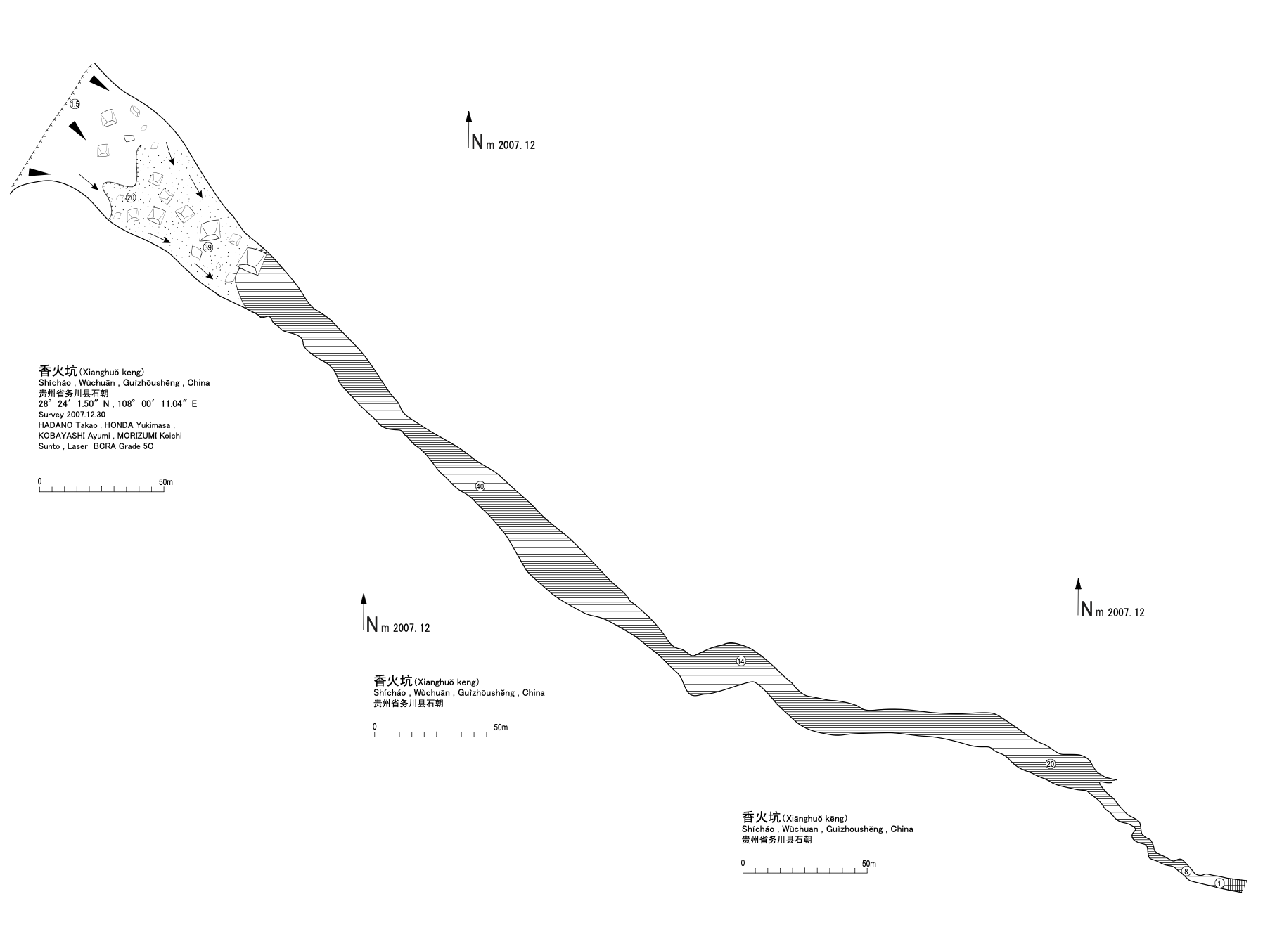
Source : Fenglin project
Expédition 1
Cette grotte a été identifiée ou explorée au minimum par cette (ces) expédition (s) :
Recherche