
Grottes et karsts de Chine
Sur les traces de Xu Xiake
 Luoshuidong - 落水洞
Détail
Autres noms : Prospectors Cave
Province, Préfecture, District :
Guizhou 贵州省, Qianxinan 黔西南布依族苗族自治州, Anlong 安龙
Latitude Nord - Longitude Est :
25.300751 - 105.533609
Altitude (m) : 0
Développement (m) : 308
Profondeur (m) :
Profondeur - / + (m) : 0 /
Volume (m3) :
Carte
Description 1
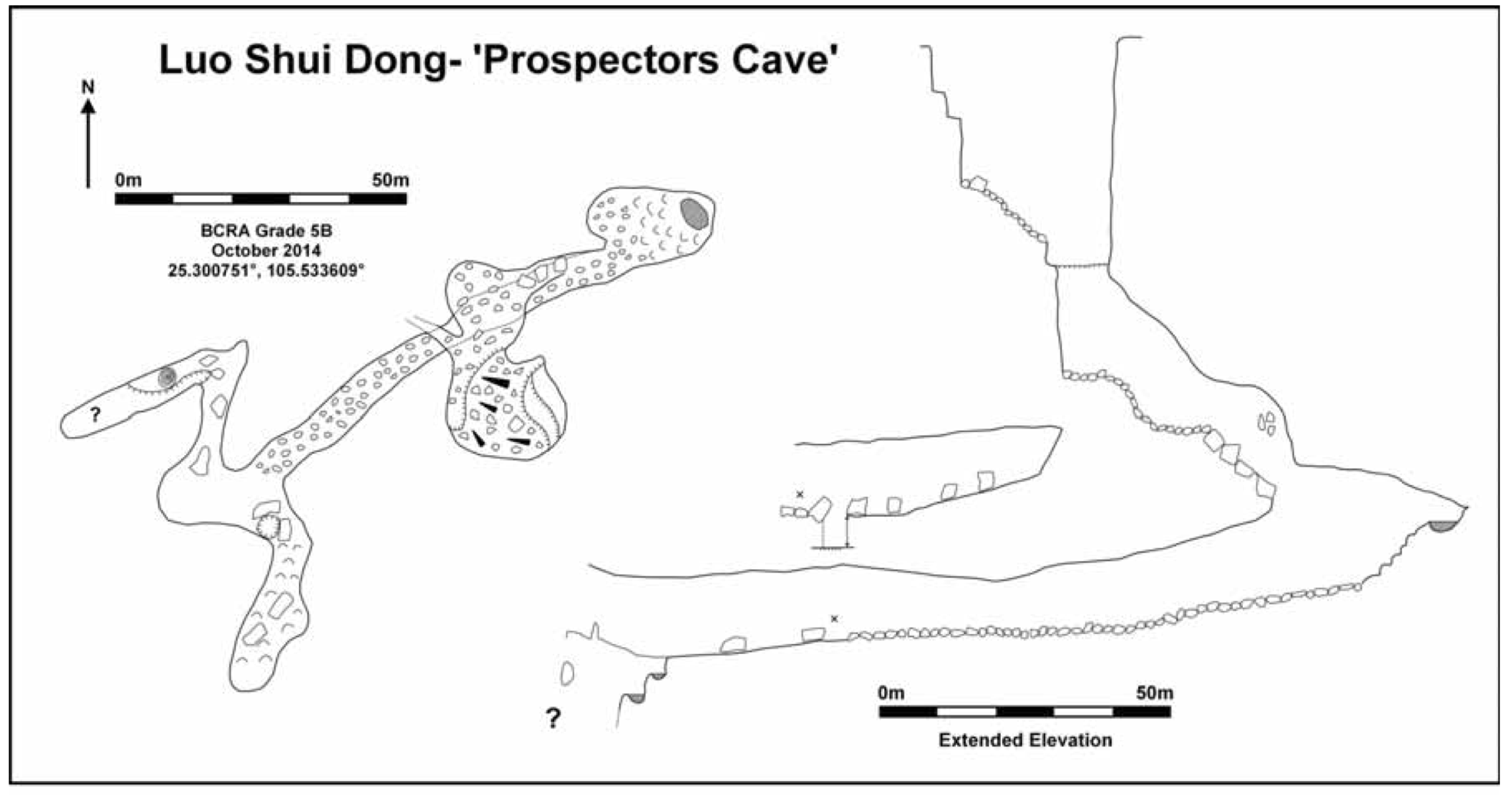
Luo Shui Dong- ‘Prospectors Pot’- 25.300751°, 105.533609°
Luo Shui Dong is an open pothole associated with a stream sinking close to the sandstone/limestone boundary. The entrance pitch was rigged from the eastern side, although local farmers demonstrated that it was possible to climb down further on the opposite side. The pitch descends 25m through vegetation before landing on a steep slope of loose boulders. A further descent of 10m down the slope requires use of a rope before a second vertical pitch is met. This pitch is 25m deep and canyon-like in nature. At the bottom the boulder strewn floor is clean washed and suggests a powerful stream runs in wet conditions. Around to the right a steep rift of jammed boulders leads to a vertical pitch (25m in total) landing in a 6x8m passage. This continues for 100m to a junction. Left soon terminates in a calcite slope, but right leads to a deep pitch which was not descended due to lack of time and equipment. Luo Shui Dong is located in an interesting position, whose further exploration may intersect more horizontal caves at valley level.
Aut. Var.The Guilin Institute of Karst Geology In association with the China Caves Project (2014)
The China Caves Project Expedition Report 2014. Report to the Anlong People’s Government
Analyse :
Rapport d’expédition dans le district de Anlong (Guizhou). 69 pages, 3 cartes, 28 photos couleurs, 12 topographies.
1104 caractères - Lu 130 Fois
Bibliographie 1
Aut. Var.The Guilin Institute of Karst Geology In association with the China Caves Project (2014)
The China Caves Project Expedition Report 2014. Report to the Anlong People’s Government
Rapport d’expédition dans le district de Anlong (Guizhou). 69 pages, 3 cartes, 28 photos couleurs, 12 topographies.
Source :
Images 0
Topographie 1
Source : Ccp
Expédition 1
Cette grotte a été identifiée ou explorée au minimum par cette (ces) expédition (s) :
Recherche